GIS Analysis
Get a Quote For Your Project
Cartography
- Map design and production for various purposes,
- Production of maps like Base Map, Thematic Map, Topographic Map etc
- Customized map creation for specific projects or applications.
- Incorporation of geographic features and data layers.
Spatial Analysis
- Geospatial data analysis for informed decision-making.
- Identification of spatial patterns and trends.
- Overlay analysis to integrate multiple data layers.
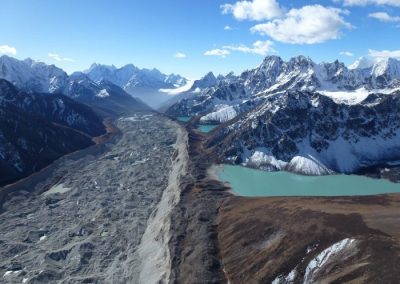
Remote Sensing
- Satellite and aerial image interpretation.
- Monitoring and analysis of land cover and land use changes.
- Environmental monitoring using remotely sensed data.
Geospatial Database Management
- Design and management of spatial databases.
- Integration of GIS data with other databases.
- Maintenance and updating of geospatial databases.
Spatial Data Infrastructure (SDI)
- Planning and development of SDI frameworks.
- Integration of geospatial data from different sources.
- Implementation of SDI standards and best practices.
Web GIS Applications
- Design and development of web-based GIS applications.
- Interactive mapping applications for public access.
- Mobile GIS solutions for field data collection.
3D GIS and Visualization
- Creation of three-dimensional representations of geographic data.
- Visualization of spatial information in 3D.
- 3D modeling and analysis for urban planning and infrastructure projects.
Custom GIS Solutions
- Tailored GIS solutions for specific industries or projects.
- Automation of GIS workflows for increased efficiency.
- Integration with other software systems.